Our self-guided cycling trip from Trieste to Pula

As you will have realised, this trip is of the two-wheeled variety, and not one that we did aboard Lady M.

It is a trip we had arranged to do with a couple of cycling buddies from the UK with whom we have enjoyed some lovely bike rides over the years in places as far afield as Piemonte in Italy, Andalusia in Spain, and the Mekhong delta in Vietnam.

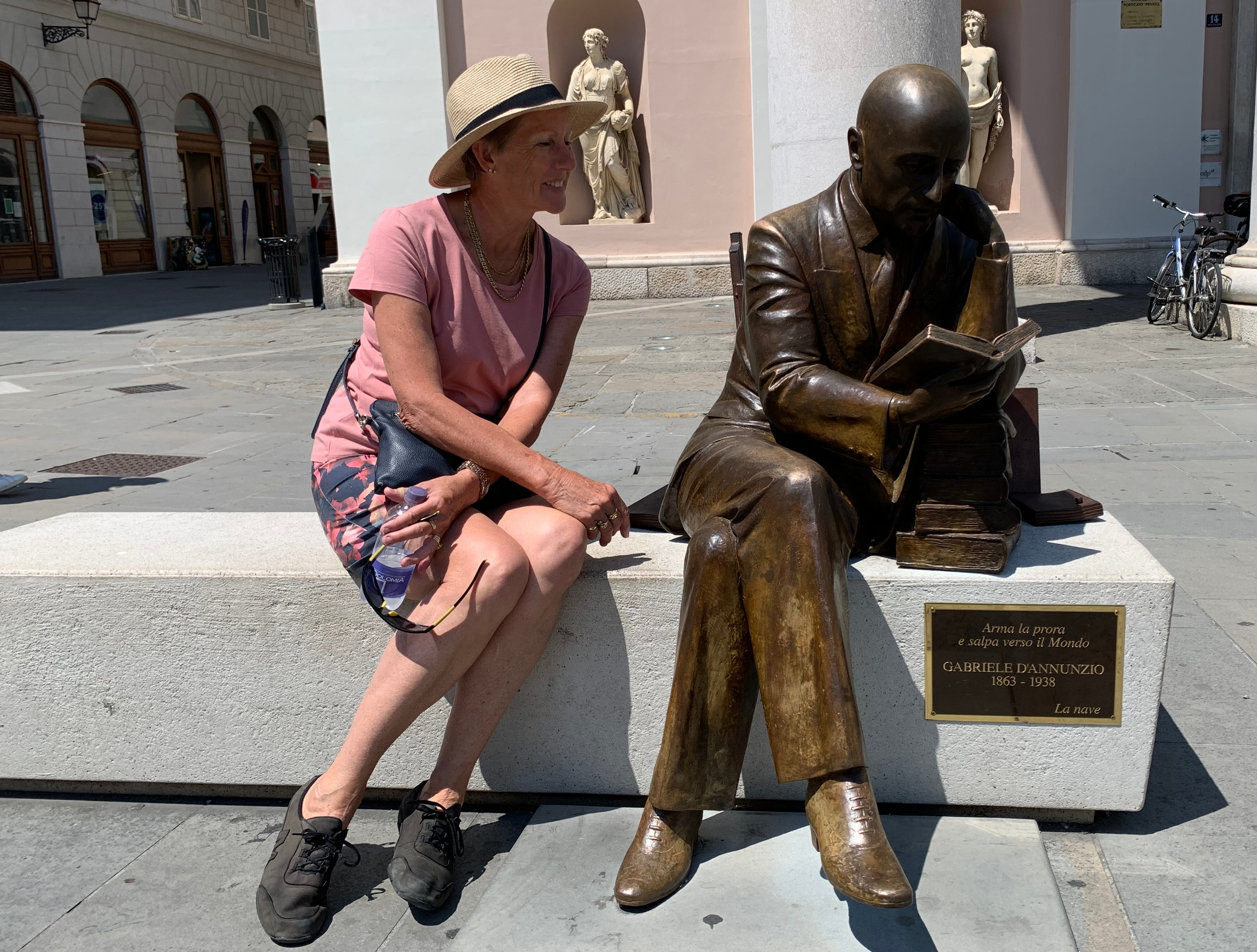
With Lady M safely moored in Diksmuide, we took the train to Brussels and flew to Trieste on 14 July – it was a long day! Meeting up with our friends on Friday 15 July, we spent a warm and sunny Friday and Saturday exploring this wonderful city, before heading south on Sunday morning for five cycling days, with a day off in between to rest and explore Porec. The climbs were manageable and the distances were not daunting, however the July temperatures were a bit of a challenge, with forecasts of 32C to 34C along the coast, and actual temperatures of 35C or more in the higher inland sections.

The overall route map for the journey from Trieste to Pula along the Istrian coastline (Courtesy of Radweg-Reisen GmbH)
These are the corresponding daily vertical profiles using an exaggerated (about 85x) vertical scale: i.e. it looks a lot worse than it is in reality (Courtesy of FunActive Tours)

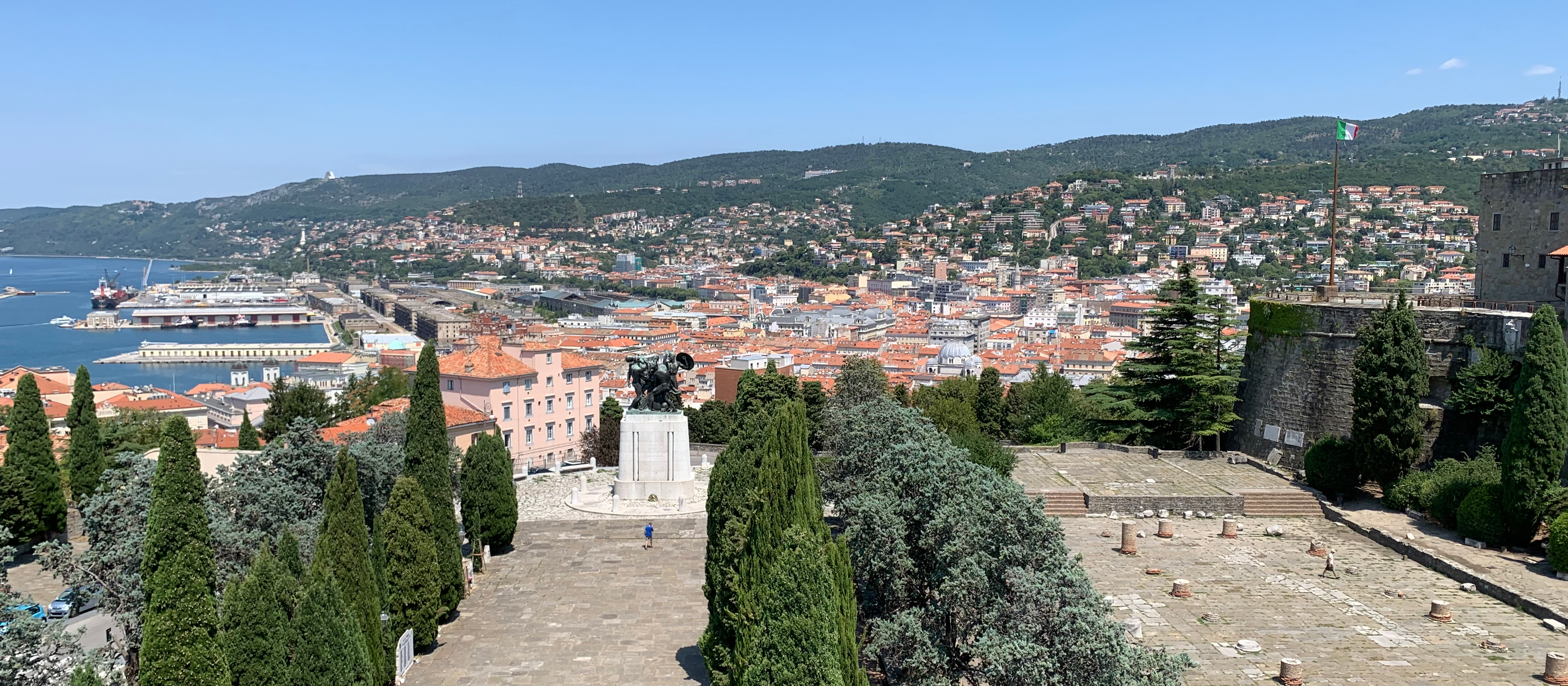
So first of all, a little bit about Trieste, an ancient city on the northern Adriatic coast which is almost surrounded by Slovenia, that none of us had visited before. Trieste became part of the Roman republic in 177 BC, but the site had been inhabited for more than 900 years before the Romans arrived. Since the Romans the city has been occupied and ruled at various times by the French, Austrians and Italians, and ultimately after WWII the narrow coastal strip of land and the city of Trieste itself became part of Italy.

First and foremost, Trieste is a popular Adriatic sea port – it still has a small fishing fleet – and is home to some large marinas, ship-building facilities and a large rail-port interface and logistics infrastructure. It’s tourist office describes Trieste as “attractive, sophisticated and cultured, and one of Italy’s most cosmopolitan cities“.

Trieste is also a popular destination for cruise ships – there were one or two of these in the port every day we were in Trieste
On the climb up the hill to the San Giusto Cathedral and the castle which overlook the city are these two churches. On the left the Santa Maria Maggiore built in the 1,600’s, and on the right the San Silvestro Basilica, built of local stone in the 12th century, and the oldest place of worship in Trieste
At the top of the hill is Trieste’s San Giusto Cathedral, an interesting architectural conglomeration with components from the 5th to 14th centuries, and plenty of restoration along the way. The bell tower dates from the 1,340’s
6th century mosaic floor tiles in one of the three naves inside the San Giusto Cathedral
The view looking north over central Trieste from the bell tower of Trieste’s San Giusto Cathedral. Ramparts of the San Giusto castle on the right overlooking column bases of a Roman building, with the Trieste War Memorial slightly below and left of centre. The Slovenian border is only a few kilometres beyond the hills along the horizon

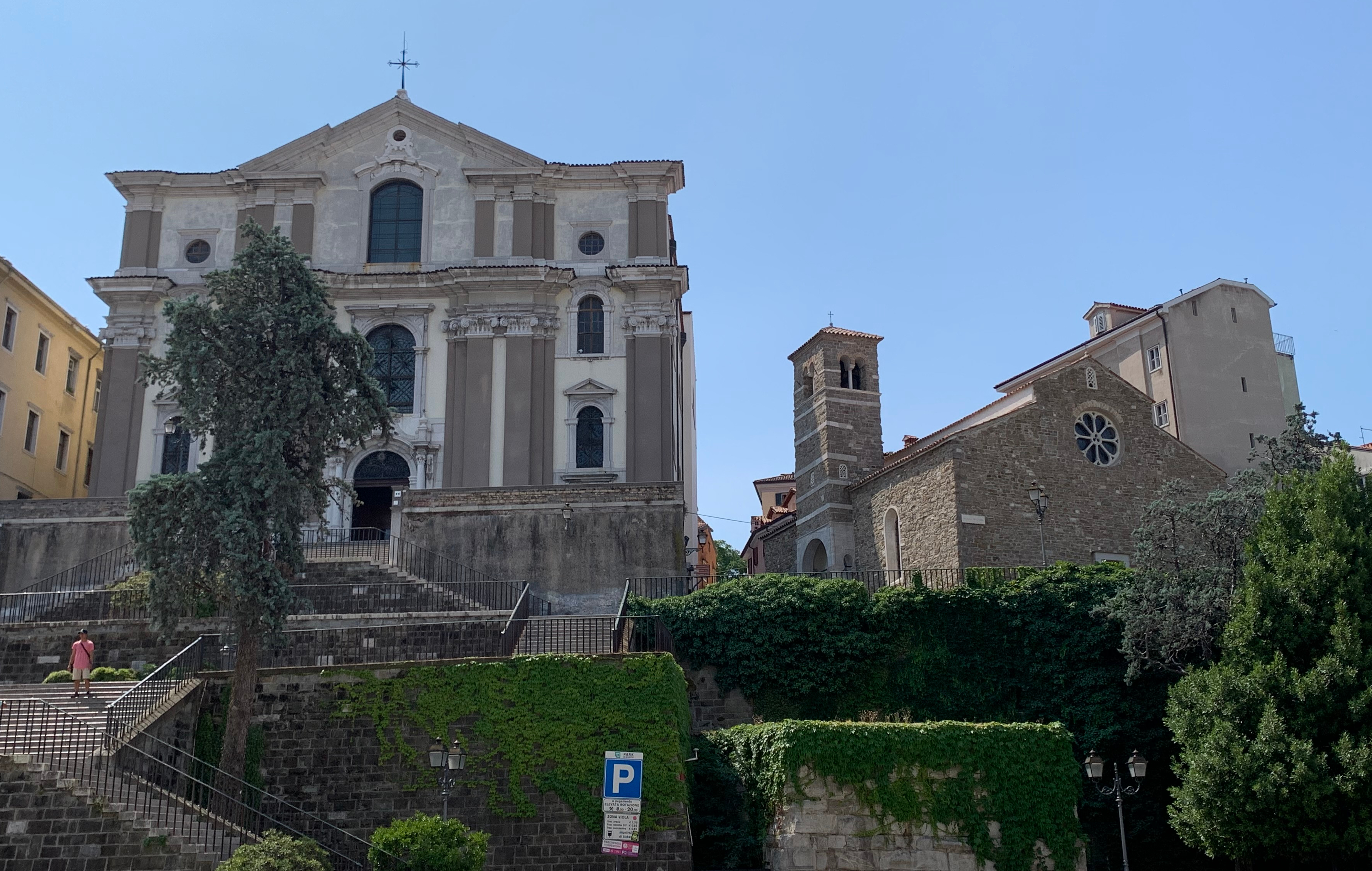
While you are on top of the hill, a visit to the Winckelmann Museum, whose entrance is adjacent to the Cathedral, is highly recommended. This museum has a vast collection of Roman and Egyptian archeology both inside the museum building and within the large walled gardens which extend back down the hill. The museum is named after Johann Joachim Winckelmann, considered in Italy to be a founding father of Archaeology and Art History, who was murdered during a robbery whilst waiting in Trieste to catch a ship to complete his trip from Vienna to Rome.

Amongst all the wonderful ancient artifacts we saw in the museum (and there are a lot !), we thought that the complete collection of Roman coins dating from Emperor Augustus (27BC to 14AD) to Emperor Theodosius (379 to 395AD) was quite something!

Over 400 years of Roman coins side by side . . . . .
. . . . . and notice how the quality and sophistication of the finished product gradually improved along the way
Back in downtown Trieste, and in addition to the Piazza Unita d’Italia there is plenty of other grand and imposing architecture which boasts of Trieste’s wealthy trading history, including the columned Palazzo Della Borsa (1802) which was once a private residence and is now a business premises
Nearby is the popular life-size bronze sculpture of Gabriele D’Annunzio who (according to Wikipedia) was an ultra-nationalist Italian poet, playwright, orator, journalist, aristocrat, and army officer in WWI
And another thing we didn’t know about Trieste – it is the home of the illy coffee brand, which was founded in Trieste in 1933 by Francesco Illy. He also invented the “illetta” coffee machine, which is considered to be the blueprint of modern-day espresso machines. And where would we all be without him?
And back to business – here are the happy cyclists on the morning of Day 1, at our start point at Piazza Unita d’Italia, the city’s three-sided main square which faces into the Adriatic

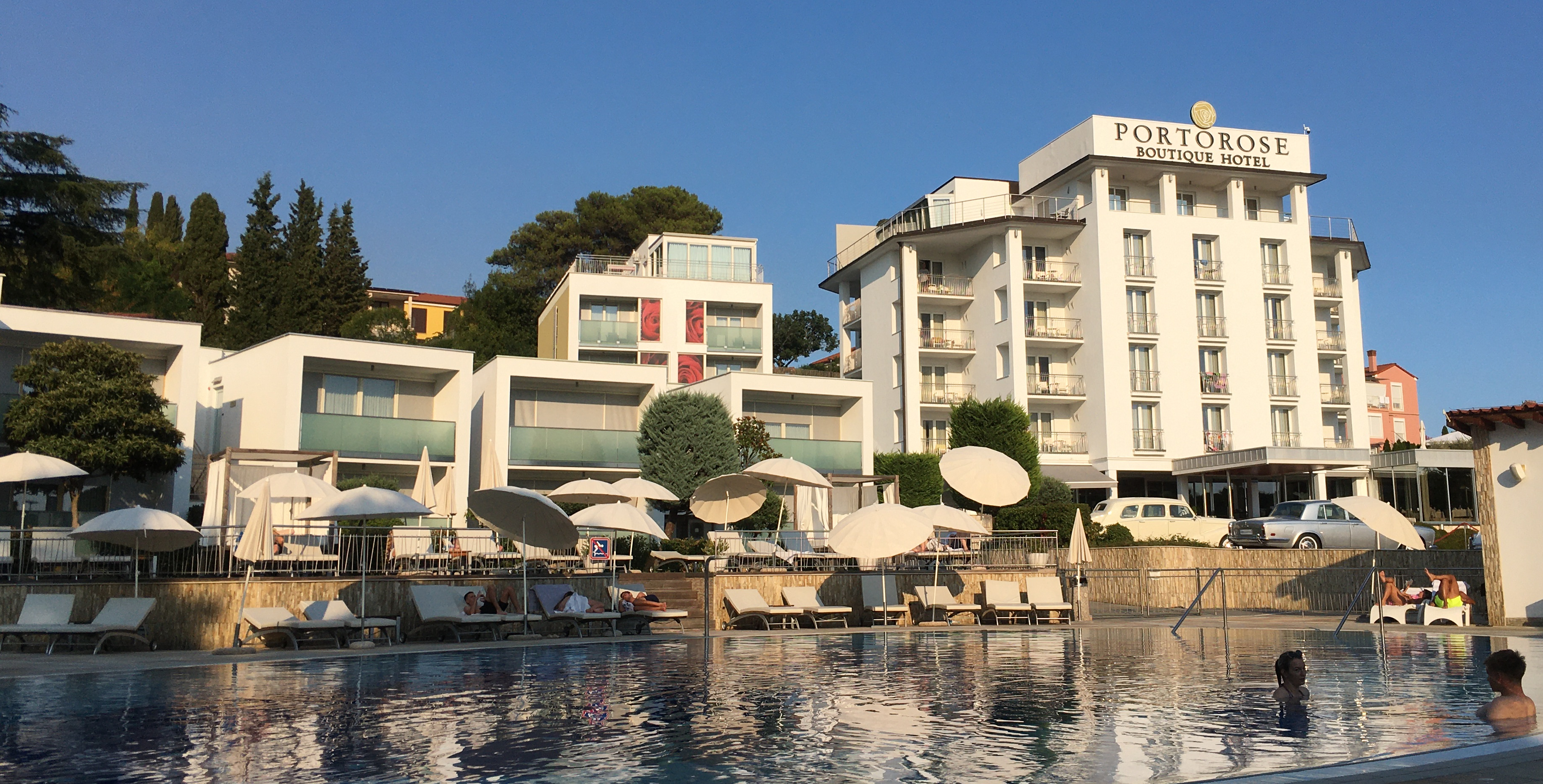
As with most of our rides, Day 1 was a settling down, bike adjusting, generally hard working event, and this one was no different. We don’t even have a photo to show for the 65km journey around the Muggia bay and on to the seaside resort town of Portoroz in Slovenia, but we do have some taken at the lovely hotel at the end of the day which had, amongst other things, comfortable rooms, ice-cold beers and a swimming pool.

Our hotel in Portoroz, Slovenia – note the Rolls Royce and Jaguar on display in the forecourt
The owner of the hotel had a collection of Indian motorcycles inside the hotel, and they were all in immaculate condition like this 1916 model! He also had about half-a-dozen historic Rolls Royce and Jaguar cars on display outside in the forecourt of the hotel
This Indian is even older – that saddle doesn’t look too comfy though

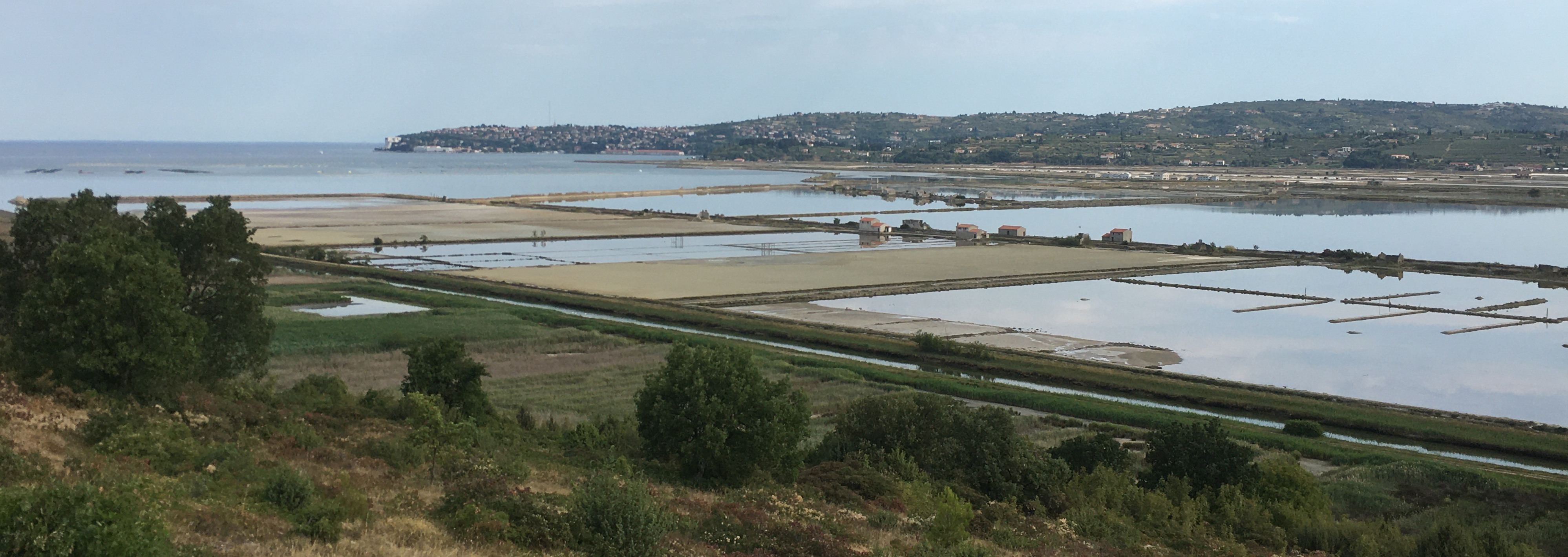
Day 2 took us to the Croatian town of Novigrad, about 60km for the day, and we started a bit earlier to try and minimise our exposure to the afternoon heat. We initially skirted a large estuary with huge marina, solar salt farms and a nature reserve before crossing the border into Croatia.

View back towards Portoroz across the estuary salt pans as we climb towards the Slovenia – Croatia border post

A very rude and miserable immigration officer shouted for us to come through the control post on our bikes – but only after he had watched us dismount and carefully park them and approach his booth!

Jo, Elaine and Chris raring to go again after a drink break on the way to the border crossing

Initially we were riding across country following gravel paths above the coast, but we soon dropped onto the busy coastline, passing lots of caravan parks, beach-side resorts, holiday homes and the hundreds of holidaymakers who migrate to the beach for their summer holidays and worship the sun.

Looking across the small harbour at Savudrija where we stopped for a coffee break after re-joining the coastal path
A well-earned lunch of pizza and beer at Minerva in a lovely shaded garden setting, and only a 5km downhill trip to our overnight stop at Novigrad
Colourfully decorated street in Novigrad on our way to the small harbour
Sunset at Novigrad’s small harbour – lots of small family-owned fishing boats, and of course seafood is always the popular choice on the menu

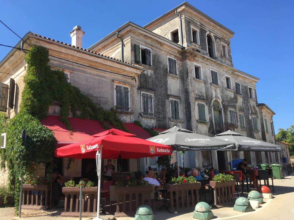
Day 3 was a short ride of only 20km from Novigrad to Porec, with a few small climbs, but nevertheless rather hot. We stopped for a coffee break in the sleepy, rather grimy and aptly-named town of Tar. The Croatian currency is the Kuna (A$1 = kn5 approx), and our coffee’s were kn6 each, though we noted the locals were all drinking beer at 10am. When the bill arrived we discovered it was cheaper to drink beer at kn8 for a 330ml glass than bottled water at kn18 for 500ml.

The scene of our coffee break in Tar – the state of this once-grand building was typical of most of the town (reminded us of a brief visit we made to Mexico in the early 90’s)

We managed to get an early check-in to our hotel at 12 noon, had another memorable lunch and spent the remainder of the day wandering the small city of Porec, and with the promise of a rest day tomorrow (not that we really needed one).

And they even have that illy coffee in Porec too

Porec is another ancient city with about 2,000 years of history, the oldest part of which sits on a small peninsula jutting into the sea and has a small harbour protected by the island of Sveti Nikola (Saint Nicholas) just a few hundred metres offshore.

View west towards the Adriatic from the small harbour, with the trees of Saint Nicholas island on the left, and the peninsula of the old city on the right

Porec is home to the 6th-century Euphrasian Basilica which we found well worth our visit. The first cathedral existed here in the 4th-century, but is was enlarged in the 5th century and then substantially rebuilt on the same site by Bishop Euphrasius in the 6th century. Archaeologists continue to excavate and find the 4th and 5th-century architecture and artifacts which were buried in the reconstruction.

View of part of the Basilica’s Bishop’s palace with the Bell Tower on the left and part of the city walls on the right
View of the entrance to the Basilica from the internal courtyard. Note the extremely detailed carved stone column capitals, and the frescoes adjacent to the windows
4th -century mosaic and carved stonework recovered from archaeological excavations, both with fish, the symbol of the Christianity
4th-century mosaic fragment. Apparently it was common practice to commemorate financial donors to the church with such works of art
The Basilica’s central nave with its dome decorated in gold and multi-coloured mosaic, not dissimilar to the nave of Trieste’s San Giusto Cathedral. Note also the beautifully carved arches and column capitals on the left
And of course, eventually it was sundowner time again. A wry smile on Chris’s face because the owner kindly gave us a huge bowl of crisps and a free shot of the local Grappa each to try and tempt us into staying for dinner (but we had other ideas)
Elaine and Jo are very happy after scoring a table for dinner on the terrace with a perfect view for the coming sunset
Our after-dinner sunset – who needs dessert with a treat like this?

Day 4 was a moderately challenging 51km ride from Porec to Rovinj, which comprised gradually climbing inland for about 28km to skirt the Limski Canal, followed by a 6km downhill into the gorge, then immediately followed by a 150m climb out of the gorge over about 2.5km (i.e. about 6% average), and then generally downhill for about 15km to Rovinj. We were all pleased to complete the day despite the 35C temperature – rewarded with a cool shower, cold beer and a fresh tuna steak dinner in a local alleyway restaurant in the old part of the city.

Daily workhorse – a fishing boat moored on the wharf on our afternoon walk into Rovinj

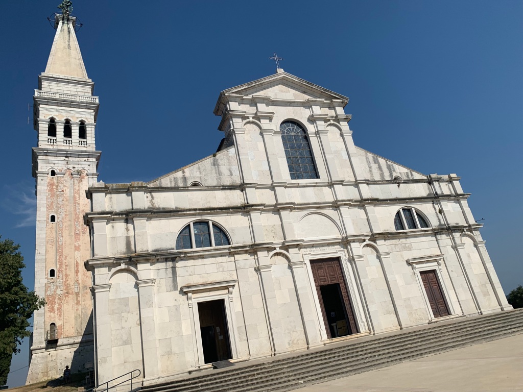
Like Porec, the city of Rovinj is built on a peninsula (however it was once an island, before the land was filled to connect it to the mainland), however this peninsula has some decent contours to it, with the Saint Euphemia Church and its tower dominating the hilltop.

Panorama of Rovinj on the walk into the city along the wharf (Photo courtesy of Alessandro Vecchi – Own work, CC BY-SA 3.0, https://commons.wikimedia.org/w/index.php?curid=25217181)
The rather dull but imposing Saint Euphemia Church set on a large terrace at the top of the hill – worth the pilgrimage, but none of us had the legs left to climb the tower

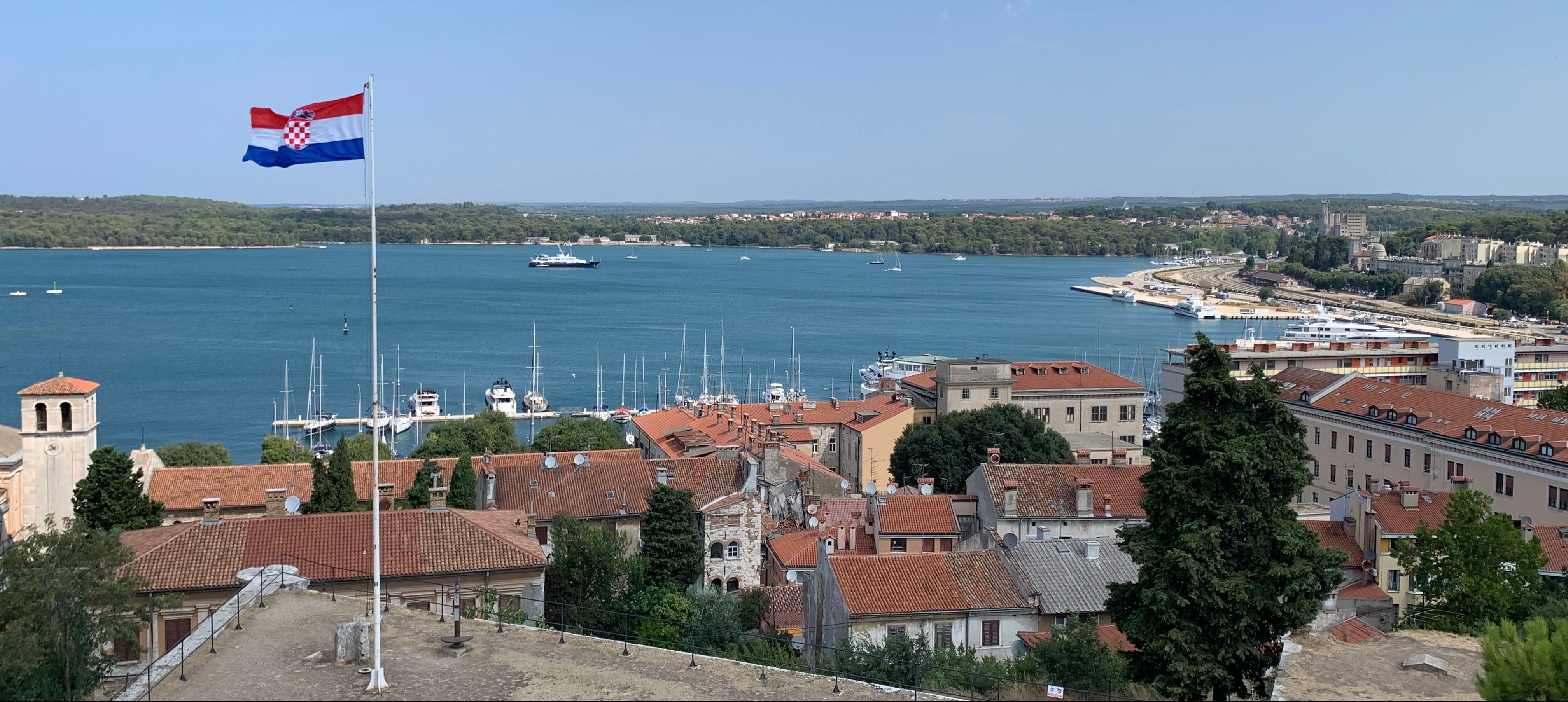
Our final cycling day was a 42km ride down to Pula, a large and ancient city near the southern tip of Croatia’s Istrian Peninsula, with a very large natural protected harbour. Pula has been occupied since the prehistoric era, probably because of its strategic location. The Romans, Ostrogoths and Venetians, as well as the Allied Forces in WWII, have each administered the city at various times.

Team photo taken at Pula’s Roman Amphitheatre, which is on a similar grand scale to the one in Rome, though possibly not so well preserved
The Romans were brilliant engineers and architects
Pula’s Public Square, with the Roman era Temple of Augustus on the left, and the more recent Pula government offices on the right
In Roman times the city of Pula was walled and had a number of arched gates. This one faces east and is named the Twin Gate for obvious reason – it is the city’s only double arch

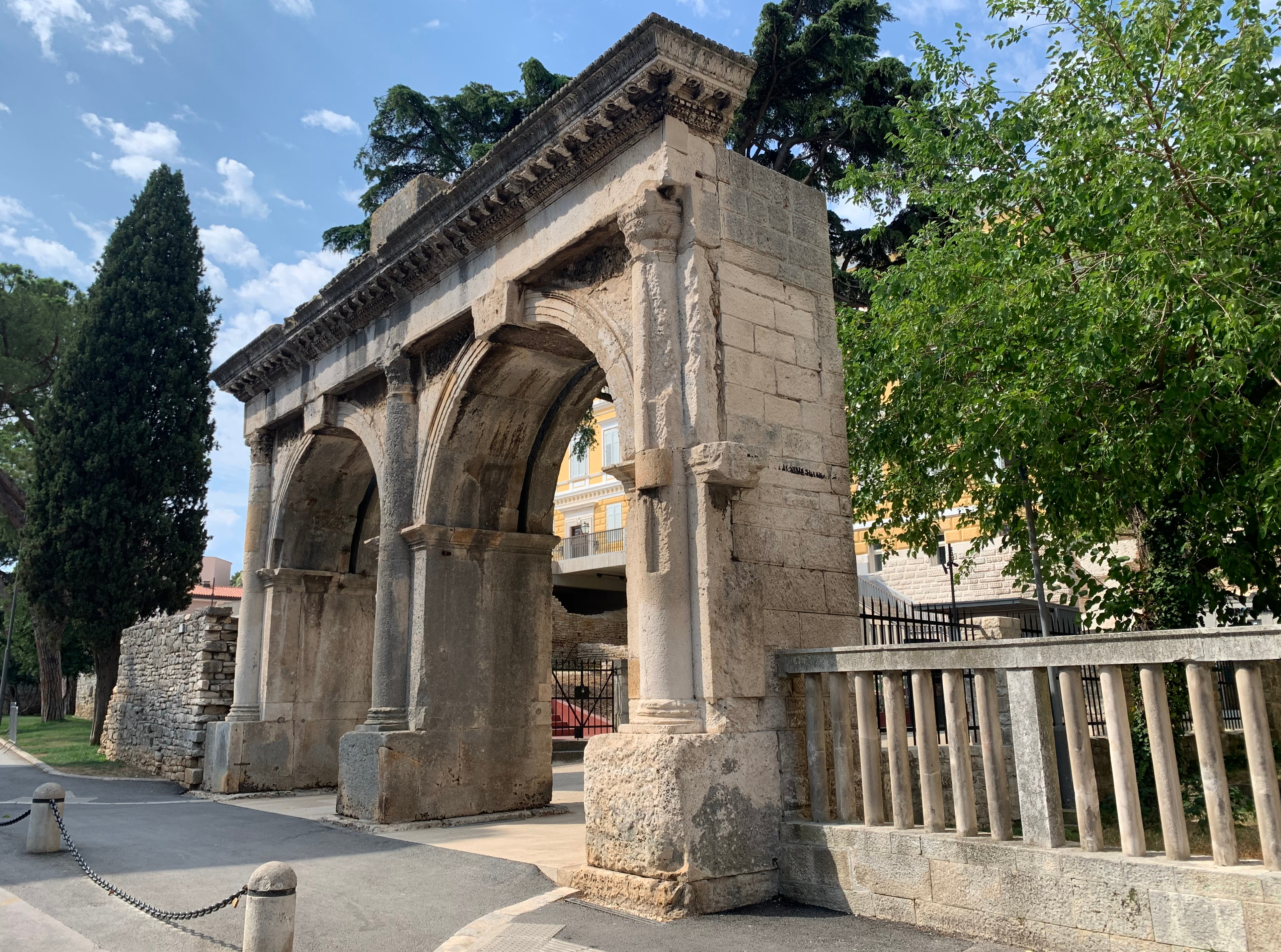
The old city is built around a small hill, the city’s highest point and the site of a Venetian fortress which was built in the 1630’s. Previously on this strategic location stood a Histri hill-fort, a Roman castrum and subsequently a medieval castle.

View looking north over the city rooftops, showing a small part of Pula’s natural harbour
An aerial view of the hilltop fortress which was designed by the French military engineer Antoine de Ville – very similar to the star-forts of the Netherlands (Photo courtesy of Google Earth)
Cannons which once protected the city, now collected together to decorate the path leading to the entrance to the fortress

On the walk back down the hill we poked our heads into the Saint Francis church and monastery which dates from 1,285 – such a very peaceful and relaxing environment, yet only a stone’s throw from the fortress and it’s cannons just above.

Shady cloisters surround the enclosed garden of Pula’s Saint Francis Monastery

We said our farewells to Chris and Jo and took a coach back to Trieste where we spent another couple of days before our flight back to Brussels on 27 July, and onward by train to Diksmuide and Lady M.

We are very fortunate to have had ‘a holiday within a holiday’, briefly visiting Trieste, Slovenia and Croatia, all of them for the first time. Cycling holidays like this are a great way to experience the sights, sounds and flavours of a country, meet the people, taste the local food (and beer and wine of course), and get a bit of exercise and physical challenge to boot.

Overall we covered 232km over the five cycling days, an average of just over 46km per day and certainly not a big distance but nevertheless quite respectable. Chris and Jo clocked up even more by going on an optional 35km ride on our “rest day”. Suffice to say a good time was had by all, and we always look forward to the next one, wherever that may be.

In our next installment we will retrace the journey on Lady M from Diksmuide to Brugge and Ghent, then head south and generally follow the French border along the south of Belgium, heading east on the home straight of our anti-clockwise navigation of Belgium – but more of that next time.

Our visit to the Western Front in Belgium

It is only a 57km journey from Brugge to Diksmuide, initially by continuing west on the Kanaal Gent-Oostende, then turning south west into the Kanaal Plassendaele-Nieuwpoort, and finally south on the Ijzer River towards Diksmuide and Ieper (Ypres in French).

PC Navigo overview route map for the Brugge to Diksmuide trip. The town of Ieper is about another 15km south of Diksmuide, but unfortunately not navigable for our Lady M

We are visiting this area because of its significance as a front line battlefield during World War I. Many readers will recognise the names of the towns and places of what was once the Western Front within Belgium. It is now named ‘Flanders Fields‘, in honour of the very moving poem ‘In Flanders Fields‘ written by a Canadian army doctor John McCrae after the death in action of his closest friend near Ieper.

WWI war sites and the position of the front line in Belgium and France [Source: WHTRN Survey 2012 (Copyright Vanneste, Vanderstraeten)]

Towns like Ieper (Ypres), Nieuwpoort, Zonnebeke, Passendale and Poperinge, and the countryside around them, were completely destroyed during the battles which were fought here from 1914 to 1918. It is estimated that more than 1 million soldiers from 50 different countries were missing, wounded or killed in this small corner of Belgium during WWI.

Flanders Fields is now a permanent place of remembrance of those who gave their lives for the freedoms that we enjoy today. The Commonwealth War Graves Commission (CWGC) maintains 23,000 cemeteries and memorial sites in more than 150 countries, including dozens here in Flanders Fields, to honour the 1.7 million men and women of the Commonwealth forces who lost their lives in the two World Wars.

But first of all, a bit about our trip from Brugge to Diksmuide, starting with the rather radical design for the Scheepsdalebrug lifting bridge on the outskirts of Brugge, the likes of which we have not seen before.

Waiting in the rain as the Scheepsdalebrug starts lifting
Looking back as the convoy comes through, note the traffic arrows on the asphalt bridge surface

We decided to overnight on a free mooring near the town of Oudenburg so that we could bus into Oostende to replace our data SIM card. It was a wet and miserable afternoon, but we were successful and continued on to Nieuwpoort the next day.

Very peaceful free public mooring (with paid power and water) on a pontoon on the outskirts of Oudenburg
And here is the corresponding free public sunset

Next stop the North Sea port of Nieuwpoort, where famously the Belgian authorities, aware of the rapidly approaching German army, opened the sea locks at the Ganzepoot (Goose Foot) lock complex in October 1914 and flooded the Ijzer valley south to Diksmuide and beyond. This halted the German advance in its tracks, and set the front line which effectively remained until the war ended four years later.

We skirted inland to avoid the tidal port, and moored at the very pleasant Westhoek Yacht Harbour, which has 220 moorings and an on-site bar and restaurant, and well located only a 1km walk into Nieuwpoort.

A rather mouldy but informative sign showing the Ganzepoot (Goose Foot) sea lock complex to Nieuwpoort
Information sign showing the extent of the flooded Ijzer River by November 1914, and the Western Front running from Nieuwpoort through Diksmuide, Knokkebrug and south to Ieper

Nieuwpoort is one of a number of towns along this coast which are connected by the Coastal Tram with 68 stops over a distance of more than 50km, from De Panne in the south to Knokke in the north – a scenic and very cost-effective way to see this part of the Belgian coast – it’s only Euro 7.50 for a day pass.

Very modern trams run up and down the coast – note the windblown beach sand in the track ballast
Typical built-up beach front at one of the major towns along the Coastal Tram route

The Domein Raversijde tram stop not far from Nieuwpoort provides access to the Atlantikwall Raversyde open air military museum, where visitors can see a small part of the German coastal defences from WWI and WWII. The Atlantikwall extended over 5,000km from the Spanish-French border all the way to the Finnish-Russian border. Along the French, Belgian and Dutch coasts alone there were more than 15,000 gun and observation bunkers.

Part of the defences in the dunes at Raversyde overlooking the Coastal Tram tracks and the beach, an anti-aircraft cannon with an observation bunker beyond
A German WWII 75mm anti-tank cannon with a range of about 8km, located in a flanking bunker

During our stay at Westhoek Harbour we witnessed a succession of unmanned self-guided / remote controlled “water barges” travelling between Diksmuide and Oostende, which requires them to navigate through the St. Joris lock adjacent to the Westhoek harbour.

One of the unmanned water barges, 400 tonne x 38m long x 5m wide, approaching the guillotine gate at the St. Joris lock
Pairs of unmanned barges often travel in “convoy” about 1km apart. Here you can see the second barge entering the lock where the first barge is already secured

We motored up to Diksmuide on on 8 July, having already arranged a 3-week long mooring there, to enable us to fly to Trieste in Italy on 14 July to do a self-guided bike ride from Trieste to Pula in Croatia (but we’ll save that story for another post). The Diksmuide Yacht Harbour is run by a friendly bunch of volunteers – it’s always good to know that Lady M is in good hands while we were away.

Our comfortable mooring on the Ijzer at Diksmuide harbour

Diksmuide was completely destroyed in WWI, and has since been rebuilt, with the buildings around the market square being replicas of the medieval buildings which once stood there. It is also home to the Yser Tower which is the central monument of the Museum on the Yser, a war memorial in the form of a 23 storey (84m high) tower with about 20 floors of displays covering multiple aspects of the two world wars. The tower commemorates the Flemish soldiers who lost their lives in WWI, and is a highly visible landmark in an otherwise very flat landscape.

View from the Yser Tower looking east over the Ijzer River with the town centre identified by the church tower at top right. The museum entrance gate and the remains of the original 1930’s war memorial are at bottom centre
The countryside looking north towards Nieuwpoort (20km away) with the Ijzer River flowing from centre right into middle distance

On Sunday 10 July we did a bike ride in search of some local “hills” (which we found, and actually enjoyed riding), and also discovered the Vredesmolen (the Peace Mill), an abandoned windmill which stands 43m above sea level, and was a strategic lookout post for the Germans during WWI.

The Vredesmolen near the village of Klerken south east of Diksmuide

Of course, many towns in Belgium have their own little brewery (we try hard not to miss them), and Diksmuide is no exception, being home to the Papegaei Brewery (Papegaei is the Dutch word for parrot). It is only open on a Sunday afternoon, but the beer is an excellent blonde, so make sure that you plan your visit accordingly!

We were able to hire a car in Diksmuide for a couple of days, which allowed us to visit a few of the main war memorial sites and other attractions in the area, many of which are located in the surrounding countryside.

Our first stop was Tyne Cot Cemetery, the final resting place of almost 12,000 servicemen, of whom more than 8,300 remain unidentified. Around the cemetery stands the curved Tyne Cot Memorial bearing the names of 35,000 UK and NZ servicemen who have no known grave. Of the 205,000 British Empire servicemen commemorated in Belgium by the CWGC, almost half have no known grave (their bodies were never found, or could not be identified). Many lie beneath a headstone bearing the inscription “Known unto God“.

A clear sunny morning and a view across a corner of the Tyne Cot cemetery, with the Stone of Remembrance in the foreground, and the Cross of Sacrifice beyond
Headstones marking the final resting place of known and unidentified soldiers

Bedford House Cemetery on the outskirts of Ieper is the final resting place of more than 5,200 soldiers almost entirely from WWI.

The cemeteries are all immaculately maintained by the CWGC
Graves of unidentified soldiers at Bedford House Cemetery

There are many cemeteries that can be visited in this area, though by the time we had wandered through the vast cemeteries of Tyne Cot and Bedford House we were left feeling very humble, very grateful, and extremely sad. What a terrible and tragic waste of life, most were only in their 20’s, and some were as young 16 and 17 years old.

Ieper is another example of a city which has been almost completely rebuilt since WWI, although there remain a fair number of historical buildings which give a grand impression as you stroll into the Grote Markt. Ieper is also home the the Menin Gate which took 4 years to build and is inscribed with the names of 54,896 missing soldiers of the Commonwealth forces who have no known final resting place.

View of the Menin Gate across Menen Street which passes through the arch, and the names of some of the almost 55,000 who were denied the honour of a burial

Starting in 1928 there is a service every evening at 8pm under the Menin Gate, when the Last Post is played by buglers in a very moving ceremony during which visiting representatives sometimes lay commemorative wreaths of poppies. We were fortunate to be able to attend this very moving ceremony on the evening of 12 July, together with about 800 others who were there to pay their respects. Long may this continue – Lest We Forget.

The view of Ieper’s Grote Markt looking east from the belfry tower of the Lakenhalle, with Menin Gate right of centre where the city buildings meet the trees alongside the city moat
A lunchtime cafe in Ieper, with doggie water bowl guarded by four cool dudes (with a wimpy looking “real” dog under the chair beyond)

Ieper was once very famous for its cloth and linen production, and is also home to the “In Flanders Fields Museum” – an extensive and interactive history of WWI housed in what was once the city’s grand medieval Cloth Hall building on the Grote Markt, and well worth a visit.

The nearby town of Poperinge is also famous as the regional centre for the growing of high quality hops used in the flavouring and bittering of beer, and is home to the National Hop Museum which is perfectly housed in an original restored hop oasting house.

The restored oasting house in Poperinge – home of the National Hop Museum
World hop production according to planted area in Hectares. In front is Germany (17,170 Ha) followed by the USA (11,880 Ha), the Czech Republic (5,659 Ha) and China (4,400 Ha). Belgium now only has 181 Ha of hop vines, whereas Australia and NZ plant 449 Ha and 403 Ha respectively, and UK has an impressive 1,187 Ha
Here are some hop vines adjacent to a maize crop on a farm just outside Poperinge. Hop growing and harvesting of the hop flowers is very labour-intensive and the yield per hectare is relatively small, consequently the price of hops is quite high compared to most other crops
And here is Elaine admiring part (about 70%) of the museum’s collection of beers brewed in Belgium
Elaine with the museum’s map showing the main hop producers and breweries in the Poperinge district

As you would expect, we couldn’t come all this way without visiting one of Belgium’s most famous Trappist breweries, the Brouwerij de Sint-Sixtusabdij van Westvleteren. Unfortunately, it is not possible for mere beer-loving mortals like us to visit the brewery itself because it is a working monastery as well as brewery, but there is a pub-restaurant only a few hundred metres away where the award winning beer can be enjoyed with a meal.

Can anyone remember ever seeing Tim looking so happy?

Poperinge was unoccupied territory during WWI, and is home to Talbot House which was established in 1915 in a historic building (built in 1790) by British army chaplains Neville Talbot and Philip Clayton, to provide a place of rest and recreation for soldiers on their way to or from the front, regardless of rank.

Talbot House, described as “Everyman’s Club”, in the heart of Poperinge, where it was established in 1915, and still operates with volunteers today as a museum as well as providing B&B accommodation for a few fortunate visitors
The very simple but lovely chapel in the loft of Talbot house, reached by a very steep staircase
And the message on the stairs to the attic – a very sobering and humbling observation
A fitting end to this post – the three very accomplished buglers who played the Last Post for us all at the service on the evening of 12 July – Thank You